| New file |
| | |
|---|
| | | <%@ page contentType="text/html;charset=UTF-8" language="java" %> |
|---|
| | | <%@ taglib prefix="c" uri="http://java.sun.com/jsp/jstl/core" %> |
|---|
| | | <!DOCTYPE html> |
|---|
| | | <html> |
|---|
| | | <head> |
|---|
| | | <meta charset="utf-8"/> |
|---|
| | | <title></title> |
|---|
| | | <script type="text/javascript" |
|---|
| | | src="http://api.map.baidu.com/api?v=2.0&ak=rER1sgBIcQxkfNSlm2wmBGZGgEERrooM"></script> |
|---|
| | | <script type="text/javascript" src="/js/jquery.min.js"></script> |
|---|
| | | </head> |
|---|
| | | <style type="text/css"> |
|---|
| | | body, |
|---|
| | | html, |
|---|
| | | #mapCanvas { |
|---|
| | | width: 100%; |
|---|
| | | height: 100%; |
|---|
| | | overflow: hidden; |
|---|
| | | margin: 0; |
|---|
| | | z-index: 0; |
|---|
| | | font-size: 14px; |
|---|
| | | font-family: "微软雅黑"; |
|---|
| | | } |
|---|
| | | |
|---|
| | | .main_body { |
|---|
| | | border: 0; |
|---|
| | | margin: 0; |
|---|
| | | width: 100%; |
|---|
| | | height: 100%; |
|---|
| | | position: relative; |
|---|
| | | } |
|---|
| | | |
|---|
| | | * { |
|---|
| | | margin: 0; |
|---|
| | | padding: 0; |
|---|
| | | list-style: none; |
|---|
| | | } |
|---|
| | | |
|---|
| | | #cpm { |
|---|
| | | width: 300px; |
|---|
| | | height: 100px; |
|---|
| | | position: absolute; |
|---|
| | | background-color: #ffffff; |
|---|
| | | display: none; |
|---|
| | | left: 50%; |
|---|
| | | top: 50%; |
|---|
| | | margin-left: -150px; |
|---|
| | | margin-top: -50px; |
|---|
| | | z-index: 11; |
|---|
| | | color: #000000; |
|---|
| | | border: 2px solid #FF7F50; |
|---|
| | | font-size: 28px; |
|---|
| | | line-height: 100px; |
|---|
| | | text-align: center; |
|---|
| | | } |
|---|
| | | |
|---|
| | | .BMap_pop > img { |
|---|
| | | top: 42px !important; |
|---|
| | | margin-left: -10px; |
|---|
| | | } |
|---|
| | | |
|---|
| | | .BMap_pop div:nth-child(1) div { |
|---|
| | | display: none; |
|---|
| | | } |
|---|
| | | |
|---|
| | | .BMap_pop div:nth-child(3) { |
|---|
| | | display: none; |
|---|
| | | } |
|---|
| | | |
|---|
| | | .BMap_pop div:nth-child(5) { |
|---|
| | | display: none; |
|---|
| | | } |
|---|
| | | |
|---|
| | | .BMap_pop div:nth-child(7) { |
|---|
| | | display: none; |
|---|
| | | } |
|---|
| | | |
|---|
| | | .BMap_pop div:nth-child(9) { |
|---|
| | | top: 35px !important; |
|---|
| | | border-radius: 5px; |
|---|
| | | } |
|---|
| | | |
|---|
| | | #selectSenor { |
|---|
| | | position: absolute; |
|---|
| | | z-index: 1; |
|---|
| | | left: 30px; |
|---|
| | | top: 20px; |
|---|
| | | font-size: 20px; |
|---|
| | | background: lightgrey; |
|---|
| | | } |
|---|
| | | |
|---|
| | | button { |
|---|
| | | font-size: 15px; |
|---|
| | | } |
|---|
| | | |
|---|
| | | .sensorLevel { |
|---|
| | | position: absolute; |
|---|
| | | z-index: 1; |
|---|
| | | bottom: 20px; |
|---|
| | | right: 10px; |
|---|
| | | width: 100px; |
|---|
| | | height: 200px; |
|---|
| | | } |
|---|
| | | |
|---|
| | | </style> |
|---|
| | | |
|---|
| | | <body> |
|---|
| | | <div class="main_body"> |
|---|
| | | <div id="selectSenor"> |
|---|
| | | <input type="radio" value="e1" name="sensor" checked>PM2.5 |
|---|
| | | <input type="radio" value="e2" name="sensor">PM10 |
|---|
| | | <input type="radio" value="e17" name="sensor">TVOC |
|---|
| | | </div> |
|---|
| | | |
|---|
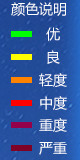
| | | <img src="/img/sensorLevel.png" class="sensorLevel"> |
|---|
| | | <div id="cpm">查无走航车轨迹</div> |
|---|
| | | <div id="mapCanvas"></div> <!-- 百度地图 --> |
|---|
| | | </div> |
|---|
| | | </body> |
|---|
| | | </html> |
|---|
| | | |
|---|
| | | <script type="text/javascript"> |
|---|
| | | var GPS = { |
|---|
| | | PI: 3.14159265358979324, |
|---|
| | | x_pi: 3.14159265358979324 * 3000.0 / 180.0, |
|---|
| | | delta: function (lat, lon) { |
|---|
| | | var a = 6378245.0; // a: 卫星椭球坐标投影到平面地图坐标系的投影因子。 |
|---|
| | | var ee = 0.00669342162296594323; // ee: 椭球的偏心率。 |
|---|
| | | var dLat = this.transformLat(lon - 105.0, lat - 35.0); |
|---|
| | | var dLon = this.transformLon(lon - 105.0, lat - 35.0); |
|---|
| | | var radLat = lat / 180.0 * this.PI; |
|---|
| | | var magic = Math.sin(radLat); |
|---|
| | | magic = 1 - ee * magic * magic; |
|---|
| | | var sqrtMagic = Math.sqrt(magic); |
|---|
| | | dLat = (dLat * 180.0) / ((a * (1 - ee)) / (magic * sqrtMagic) * this.PI); |
|---|
| | | dLon = (dLon * 180.0) / (a / sqrtMagic * Math.cos(radLat) * this.PI); |
|---|
| | | return {'lat': dLat, 'lon': dLon}; |
|---|
| | | }, |
|---|
| | | |
|---|
| | | //WGS-84 to GCJ-02 |
|---|
| | | gcj_encrypt: function (wgsLat, wgsLon) { |
|---|
| | | if (this.outOfChina(wgsLat, wgsLon)) |
|---|
| | | return {'lat': wgsLat, 'lon': wgsLon}; |
|---|
| | | |
|---|
| | | var d = this.delta(wgsLat, wgsLon); |
|---|
| | | return {'lat': wgsLat + d.lat, 'lon': wgsLon + d.lon}; |
|---|
| | | }, |
|---|
| | | //GCJ-02 to WGS-84 |
|---|
| | | gcj_decrypt: function (gcjLat, gcjLon) { |
|---|
| | | if (this.outOfChina(gcjLat, gcjLon)) |
|---|
| | | return {'lat': gcjLat, 'lon': gcjLon}; |
|---|
| | | |
|---|
| | | var d = this.delta(gcjLat, gcjLon); |
|---|
| | | return {'lat': gcjLat - d.lat, 'lon': gcjLon - d.lon}; |
|---|
| | | }, |
|---|
| | | //GCJ-02 to WGS-84 exactly |
|---|
| | | gcj_decrypt_exact: function (gcjLat, gcjLon) { |
|---|
| | | var initDelta = 0.01; |
|---|
| | | var threshold = 0.000000001; |
|---|
| | | var dLat = initDelta, dLon = initDelta; |
|---|
| | | var mLat = gcjLat - dLat, mLon = gcjLon - dLon; |
|---|
| | | var pLat = gcjLat + dLat, pLon = gcjLon + dLon; |
|---|
| | | var wgsLat, wgsLon, i = 0; |
|---|
| | | while (1) { |
|---|
| | | wgsLat = (mLat + pLat) / 2; |
|---|
| | | wgsLon = (mLon + pLon) / 2; |
|---|
| | | var tmp = this.gcj_encrypt(wgsLat, wgsLon) |
|---|
| | | dLat = tmp.lat - gcjLat; |
|---|
| | | dLon = tmp.lon - gcjLon; |
|---|
| | | if ((Math.abs(dLat) < threshold) && (Math.abs(dLon) < threshold)) |
|---|
| | | break; |
|---|
| | | |
|---|
| | | if (dLat > 0) pLat = wgsLat; else mLat = wgsLat; |
|---|
| | | if (dLon > 0) pLon = wgsLon; else mLon = wgsLon; |
|---|
| | | |
|---|
| | | if (++i > 10000) break; |
|---|
| | | } |
|---|
| | | return {'lat': wgsLat, 'lon': wgsLon}; |
|---|
| | | }, |
|---|
| | | //GCJ-02 to BD-09 |
|---|
| | | bd_encrypt: function (gcjLat, gcjLon) { |
|---|
| | | var x = gcjLon, y = gcjLat; |
|---|
| | | var z = Math.sqrt(x * x + y * y) + 0.00002 * Math.sin(y * this.x_pi); |
|---|
| | | var theta = Math.atan2(y, x) + 0.000003 * Math.cos(x * this.x_pi); |
|---|
| | | bdLon = z * Math.cos(theta) + 0.0065; |
|---|
| | | bdLat = z * Math.sin(theta) + 0.006; |
|---|
| | | return {'lat': bdLat, 'lon': bdLon}; |
|---|
| | | }, |
|---|
| | | //BD-09 to GCJ-02 |
|---|
| | | bd_decrypt: function (bdLat, bdLon) { |
|---|
| | | var x = bdLon - 0.0065, y = bdLat - 0.006; |
|---|
| | | var z = Math.sqrt(x * x + y * y) - 0.00002 * Math.sin(y * this.x_pi); |
|---|
| | | var theta = Math.atan2(y, x) - 0.000003 * Math.cos(x * this.x_pi); |
|---|
| | | var gcjLon = z * Math.cos(theta); |
|---|
| | | var gcjLat = z * Math.sin(theta); |
|---|
| | | return {'lat': gcjLat, 'lon': gcjLon}; |
|---|
| | | }, |
|---|
| | | //WGS-84 to Web mercator |
|---|
| | | //mercatorLat -> y mercatorLon -> x |
|---|
| | | mercator_encrypt: function (wgsLat, wgsLon) { |
|---|
| | | var x = wgsLon * 20037508.34 / 180.; |
|---|
| | | var y = Math.log(Math.tan((90. + wgsLat) * this.PI / 360.)) / (this.PI / 180.); |
|---|
| | | y = y * 20037508.34 / 180.; |
|---|
| | | return {'lat': y, 'lon': x}; |
|---|
| | | }, |
|---|
| | | // Web mercator to WGS-84 |
|---|
| | | // mercatorLat -> y mercatorLon -> x |
|---|
| | | mercator_decrypt: function (mercatorLat, mercatorLon) { |
|---|
| | | var x = mercatorLon / 20037508.34 * 180.; |
|---|
| | | var y = mercatorLat / 20037508.34 * 180.; |
|---|
| | | y = 180 / this.PI * (2 * Math.atan(Math.exp(y * this.PI / 180.)) - this.PI / 2); |
|---|
| | | return {'lat': y, 'lon': x}; |
|---|
| | | }, |
|---|
| | | // two point's distance |
|---|
| | | distance: function (latA, lonA, latB, lonB) { |
|---|
| | | var earthR = 6371000.; |
|---|
| | | var x = Math.cos(latA * this.PI / 180.) * Math.cos(latB * this.PI / 180.) * Math.cos((lonA - lonB) * this.PI / 180); |
|---|
| | | var y = Math.sin(latA * this.PI / 180.) * Math.sin(latB * this.PI / 180.); |
|---|
| | | var s = x + y; |
|---|
| | | if (s > 1) s = 1; |
|---|
| | | if (s < -1) s = -1; |
|---|
| | | var alpha = Math.acos(s); |
|---|
| | | var distance = alpha * earthR; |
|---|
| | | return distance; |
|---|
| | | }, |
|---|
| | | outOfChina: function (lat, lon) { |
|---|
| | | if (lon < 72.004 || lon > 137.8347) |
|---|
| | | return true; |
|---|
| | | if (lat < 0.8293 || lat > 55.8271) |
|---|
| | | return true; |
|---|
| | | return false; |
|---|
| | | }, |
|---|
| | | transformLat: function (x, y) { |
|---|
| | | var ret = -100.0 + 2.0 * x + 3.0 * y + 0.2 * y * y + 0.1 * x * y + 0.2 * Math.sqrt(Math.abs(x)); |
|---|
| | | ret += (20.0 * Math.sin(6.0 * x * this.PI) + 20.0 * Math.sin(2.0 * x * this.PI)) * 2.0 / 3.0; |
|---|
| | | ret += (20.0 * Math.sin(y * this.PI) + 40.0 * Math.sin(y / 3.0 * this.PI)) * 2.0 / 3.0; |
|---|
| | | ret += (160.0 * Math.sin(y / 12.0 * this.PI) + 320 * Math.sin(y * this.PI / 30.0)) * 2.0 / 3.0; |
|---|
| | | return ret; |
|---|
| | | }, |
|---|
| | | transformLon: function (x, y) { |
|---|
| | | var ret = 300.0 + x + 2.0 * y + 0.1 * x * x + 0.1 * x * y + 0.1 * Math.sqrt(Math.abs(x)); |
|---|
| | | ret += (20.0 * Math.sin(6.0 * x * this.PI) + 20.0 * Math.sin(2.0 * x * this.PI)) * 2.0 / 3.0; |
|---|
| | | ret += (20.0 * Math.sin(x * this.PI) + 40.0 * Math.sin(x / 3.0 * this.PI)) * 2.0 / 3.0; |
|---|
| | | ret += (150.0 * Math.sin(x / 12.0 * this.PI) + 300.0 * Math.sin(x / 30.0 * this.PI)) * 2.0 / 3.0; |
|---|
| | | return ret; |
|---|
| | | } |
|---|
| | | }; |
|---|
| | | |
|---|
| | | var params = ${requestScope.carTrajectoryParams}; |
|---|
| | | var sensorInfo = params["sensorInfo"]; |
|---|
| | | var map = new BMap.Map("mapCanvas", {enableMapClick: false}); |
|---|
| | | var mapStyle = { |
|---|
| | | features: ["road", "building", "water", "land"], // 隐藏地图上的poi |
|---|
| | | style: "normal" // 设置地图风格为高端黑 |
|---|
| | | }; |
|---|
| | | map.setMapStyle(mapStyle); |
|---|
| | | |
|---|
| | | //地图类型 |
|---|
| | | var mapType = new BMap.MapTypeControl( |
|---|
| | | { |
|---|
| | | mapTypes: [BMAP_NORMAL_MAP, BMAP_SATELLITE_MAP], |
|---|
| | | anchor: BMAP_ANCHOR_TOP_RIGHT |
|---|
| | | } |
|---|
| | | ); |
|---|
| | | map.addControl(mapType); |
|---|
| | | map.setMapType(BMAP_SATELLITE_MAP);//设置默认地图类型(卫星地图) |
|---|
| | | var navigation = new BMap.NavigationControl({ |
|---|
| | | anchor: BMAP_ANCHOR_BOTTOM_LEFT, |
|---|
| | | type: BMAP_NAVIGATION_CONTROL_LARGE |
|---|
| | | }); |
|---|
| | | map.addControl(navigation);//缩放控件 |
|---|
| | | map.enableScrollWheelZoom(true); // 开启鼠标滚轮缩放 |
|---|
| | | map.addControl(new BMap.ScaleControl()); |
|---|
| | | if (sensorInfo.length === 0) { |
|---|
| | | showNoFlightTrajectory(); |
|---|
| | | } |
|---|
| | | var trackPoints = [];//存放从后台获取到的所有历史轨迹点的数据 |
|---|
| | | var points = []; |
|---|
| | | //格子尺寸 |
|---|
| | | var size = 50; |
|---|
| | | var distance = size / 2 / Math.sin(1 * Math.PI / 4); |
|---|
| | | //要显示的因子 |
|---|
| | | var sensor = $("input[type='radio']:checked").val(); |
|---|
| | | for (var i = 0; i < sensorInfo.length; i++) { |
|---|
| | | if (typeof (sensorInfo[i]["e76"]) == "undefined") { |
|---|
| | | sensorInfo.splice(i, 1); |
|---|
| | | i--; |
|---|
| | | } else { |
|---|
| | | var lon = parseFloat(sensorInfo[i].e76.substr(0, sensorInfo[i].e76.length - 1)); |
|---|
| | | var lat = parseFloat(sensorInfo[i].e77.substr(0, sensorInfo[i].e77.length - 1)); |
|---|
| | | if (lon > 150 || lon < 70 || lat <= 20 || lat > 60) { |
|---|
| | | sensorInfo.splice(i, 1); |
|---|
| | | i--; |
|---|
| | | } |
|---|
| | | if (i > 1) { |
|---|
| | | if (sensorInfo[i]["e76"] === sensorInfo[i - 1]["e76"] && sensorInfo[i]["e77"] === sensorInfo[i - 1]["e77"]) { |
|---|
| | | sensorInfo.splice(i, 1); |
|---|
| | | i--; |
|---|
| | | } |
|---|
| | | } |
|---|
| | | } |
|---|
| | | } |
|---|
| | | |
|---|
| | | points = getShowPoints(); |
|---|
| | | |
|---|
| | | map.centerAndZoom(points, 13);// 根据经纬度显示地图的范围 |
|---|
| | | map.setViewport(points);// 根据提供的地理区域或坐标设置地图视野 |
|---|
| | | drawPolygon(sensor);//多边形 |
|---|
| | | drawLine();//轨迹路线 |
|---|
| | | drawStartAndEnd();//起点和终点标注 |
|---|
| | | |
|---|
| | | //无数据时显示 |
|---|
| | | function showNoFlightTrajectory() { |
|---|
| | | var point = new BMap.Point(120.987287, 31.391562); |
|---|
| | | map.centerAndZoom(point, 17); |
|---|
| | | setTimeout(function () { |
|---|
| | | document.getElementById("cpm").style.display = 'block'; |
|---|
| | | }, 250); |
|---|
| | | } |
|---|
| | | |
|---|
| | | //以一个为中心,一定角度,距离为distance找点 |
|---|
| | | function getPoint(angle, lng, lat, distance) { |
|---|
| | | var EARTH_RADIUS = 6378137; |
|---|
| | | //将距离转换成经度的计算公式 |
|---|
| | | var ra = distance / EARTH_RADIUS; |
|---|
| | | // 转换为radian,否则结果会不正确 |
|---|
| | | angle = angle / 180 * Math.PI; |
|---|
| | | lng = lng / 180 * Math.PI; |
|---|
| | | lat = lat / 180 * Math.PI; |
|---|
| | | lng = lng + Math.atan2(Math.sin(angle) * Math.sin(ra) * Math.cos(lat), Math.cos(ra) - Math.sin(lat) * Math.sin(lat)); |
|---|
| | | lat = Math.asin(Math.sin(lat) * Math.cos(ra) + Math.cos(lat) * Math.sin(ra) * Math.cos(angle)); |
|---|
| | | // 转为正常的10进制经纬度 |
|---|
| | | lng = lng * 180 / Math.PI; |
|---|
| | | lat = lat * 180 / Math.PI; |
|---|
| | | return new BMap.Point(lng, lat); |
|---|
| | | } |
|---|
| | | |
|---|
| | | //多边形填充颜色 |
|---|
| | | function getColor(senosor, data) { |
|---|
| | | var color; |
|---|
| | | switch (sensor) { |
|---|
| | | case 'e1': |
|---|
| | | if (data < 35) { |
|---|
| | | color = '#0FB820'; |
|---|
| | | } else if (data < 75) { |
|---|
| | | color = '#B8B002'; |
|---|
| | | } else if (data < 115) { |
|---|
| | | color = '#E55F03'; |
|---|
| | | } else if (data < 150) { |
|---|
| | | color = '#C9031B'; |
|---|
| | | } else if (data < 250) { |
|---|
| | | color = '#C00160'; |
|---|
| | | } else { |
|---|
| | | color = '#BC0238'; |
|---|
| | | } |
|---|
| | | break; |
|---|
| | | case 'e2': |
|---|
| | | if (data < 50) { |
|---|
| | | color = '#0FB820'; |
|---|
| | | } else if (data < 150) { |
|---|
| | | color = '#B8B002'; |
|---|
| | | } else if (data < 250) { |
|---|
| | | color = '#E55F03'; |
|---|
| | | } else if (data < 350) { |
|---|
| | | color = '#C9031B'; |
|---|
| | | } else if (data < 420) { |
|---|
| | | color = '#C00160'; |
|---|
| | | } else { |
|---|
| | | color = '#BC0238'; |
|---|
| | | } |
|---|
| | | break; |
|---|
| | | case 'e17': |
|---|
| | | if (data < 1.5) { |
|---|
| | | color = '#0FB820'; |
|---|
| | | } else if (data < 3) { |
|---|
| | | color = '#B8B002'; |
|---|
| | | } else if (data < 5) { |
|---|
| | | color = '#E55F03'; |
|---|
| | | } else { |
|---|
| | | color = '#BC0238'; |
|---|
| | | } |
|---|
| | | break; |
|---|
| | | default: |
|---|
| | | color = '#0FB820'; |
|---|
| | | break; |
|---|
| | | } |
|---|
| | | return color; |
|---|
| | | } |
|---|
| | | |
|---|
| | | //画方块,上色,添加文字 |
|---|
| | | function drawPolygon(sensor) { |
|---|
| | | $.each(points, function (item, point) { |
|---|
| | | var sw = getPoint(225, point.lng, point.lat, distance); |
|---|
| | | var ne = getPoint(45, point.lng, point.lat, distance); |
|---|
| | | var data = point[sensor]; |
|---|
| | | //根据因子浓度变换方块颜色 |
|---|
| | | color = getColor(sensor, data); |
|---|
| | | var polygon = new BMap.Polygon([ |
|---|
| | | new BMap.Point(sw.lng, sw.lat),//左下角 |
|---|
| | | new BMap.Point(ne.lng, sw.lat),//左上角 |
|---|
| | | new BMap.Point(ne.lng, ne.lat),//右上角 |
|---|
| | | new BMap.Point(sw.lng, ne.lat)//右下角 |
|---|
| | | ], {strokeWeight: 0.5, strokeOpacity: 0.5, fillColor: color}); |
|---|
| | | map.addOverlay(polygon); |
|---|
| | | //方块内添加label文本 |
|---|
| | | setLabelStyle(data, point); |
|---|
| | | }); |
|---|
| | | } |
|---|
| | | |
|---|
| | | //绘制带箭头折线 |
|---|
| | | function drawLine() { |
|---|
| | | //绘制箭头及其样式 |
|---|
| | | var sy = new BMap.Symbol(BMap_Symbol_SHAPE_BACKWARD_OPEN_ARROW, { |
|---|
| | | scale: 0.6,//图标缩放大小 |
|---|
| | | strokeColor: 'white',//设置矢量图标的线填充颜色 |
|---|
| | | strokeWeight: 3,//设置线宽 |
|---|
| | | }); |
|---|
| | | var icons = new BMap.IconSequence(sy, '100%', '4%', false);//设置为true,可以对轨迹进行编辑 |
|---|
| | | //绘制折线以及样式 |
|---|
| | | var trackLine = new BMap.Polyline(points, { |
|---|
| | | strokeColor: "red",//设置颜色 |
|---|
| | | strokeWeight: 4,//宽度 |
|---|
| | | strokeOpacity: 0.3,//折线的透明度,取值范围0 - 1 |
|---|
| | | enableEditing: false,//是否启用线编辑,默认为false |
|---|
| | | enableClicking: false,//是否响应点击事件,默认为true |
|---|
| | | icons: [icons], |
|---|
| | | }); |
|---|
| | | map.addOverlay(trackLine); |
|---|
| | | } |
|---|
| | | |
|---|
| | | //起点和终点标注 |
|---|
| | | function drawStartAndEnd() { |
|---|
| | | var startIcon = new BMap.Icon("/img/start.png", new BMap.Size(48, 48)); |
|---|
| | | var startMark = new BMap.Marker(points[0], {icon: startIcon, offset: new BMap.Size(0, -20)}); |
|---|
| | | map.addOverlay(startMark); |
|---|
| | | var endIcon = new BMap.Icon("/img/end.png", new BMap.Size(48, 48)); |
|---|
| | | var endMark = new BMap.Marker(points[points.length - 1], {icon: endIcon, offset: new BMap.Size(0, -20)}); |
|---|
| | | map.addOverlay(endMark); |
|---|
| | | } |
|---|
| | | |
|---|
| | | //格子间隔>=50m的放进points |
|---|
| | | function getShowPoints() { |
|---|
| | | points.push(convertPoint(0)); |
|---|
| | | for (var i = 1; i < sensorInfo.length; i++) { |
|---|
| | | var flag = true; |
|---|
| | | var point1 = convertPoint(i); |
|---|
| | | var sw1 = getPoint(225, point1.lng, point1.lat, distance); |
|---|
| | | var ne1 = getPoint(45, point1.lng, point1.lat, distance); |
|---|
| | | for (var j = 0; j < points.length; j++) { |
|---|
| | | var point2 = points[j]; |
|---|
| | | var dis = parseInt(map.getDistance(point1, point2)); |
|---|
| | | if (dis < size) { |
|---|
| | | flag = false; |
|---|
| | | } |
|---|
| | | } |
|---|
| | | if (flag) { |
|---|
| | | points.push(point1); |
|---|
| | | } |
|---|
| | | } |
|---|
| | | return points; |
|---|
| | | } |
|---|
| | | |
|---|
| | | //point上添加label文本 |
|---|
| | | function setLabelStyle(content, point) { |
|---|
| | | var label = new BMap.Label("<span class='my-maptip'>" + content + "<br /><span>",//为lable填写内容 |
|---|
| | | { |
|---|
| | | offset: new BMap.Size(-8, -10),//label的偏移量,为了让label的中心显示在点上 |
|---|
| | | position: point |
|---|
| | | } |
|---|
| | | );//label的位置 |
|---|
| | | |
|---|
| | | var offsetSize = new BMap.Size(0, 0); |
|---|
| | | var size = "10px"; |
|---|
| | | if (map.getZoom() <= 16) { |
|---|
| | | size = "0px"; |
|---|
| | | } |
|---|
| | | var labelStyle = { |
|---|
| | | border: "0", |
|---|
| | | fontSize: size, |
|---|
| | | height: "20px", |
|---|
| | | lineHeight: "20px", |
|---|
| | | fontFamily: "微软雅黑", |
|---|
| | | backgroundColor: "0.05", |
|---|
| | | fontWeight: "bold" |
|---|
| | | }; |
|---|
| | | label.setStyle(labelStyle); |
|---|
| | | map.addOverlay(label); |
|---|
| | | } |
|---|
| | | |
|---|
| | | //地图缩放级别监控 |
|---|
| | | map.addEventListener("zoomend", function () { |
|---|
| | | //这里根据缩放显示和隐藏文本 |
|---|
| | | var zoom = this.getZoom(); |
|---|
| | | $('span.my-maptip').parent()[zoom <= 16 ? 'hide' : 'show'](); |
|---|
| | | $('span.my-maptip').parent().css("font-size", 30 - zoom); |
|---|
| | | }); |
|---|
| | | |
|---|
| | | $("#selectSenor").change(function () { |
|---|
| | | map.clearOverlays() |
|---|
| | | sensor = $("input[type='radio']:checked").val(); |
|---|
| | | drawPolygon(sensor); |
|---|
| | | drawLine(); |
|---|
| | | drawStartAndEnd(); |
|---|
| | | }) |
|---|
| | | |
|---|
| | | //获取经纬度点 |
|---|
| | | function convertPoint(index) { |
|---|
| | | var value = sensorInfo[index]; |
|---|
| | | if (typeof (value.e76) == "undefined") { |
|---|
| | | showNoFlightTrajectory(); |
|---|
| | | } |
|---|
| | | var lon = parseFloat(value.e76.substr(0, value.e76.length - 1)); |
|---|
| | | var lat = parseFloat(value.e77.substr(0, value.e77.length - 1)); |
|---|
| | | var m = GPS.gcj_encrypt(lat, lon).lon; |
|---|
| | | var n = GPS.gcj_encrypt(lat, lon).lat; |
|---|
| | | lon = GPS.bd_encrypt(n, m).lon; |
|---|
| | | lat = GPS.bd_encrypt(n, m).lat; |
|---|
| | | var point = new BMap.Point(lon, lat); |
|---|
| | | point['e1'] = parseInt(sensorInfo[index]['e1']); |
|---|
| | | point['e2'] = parseInt(sensorInfo[index]['e2']); |
|---|
| | | point['e17'] = parseFloat(sensorInfo[index]['e17']).toFixed(2); |
|---|
| | | return point; |
|---|
| | | } |
|---|
| | | |
|---|
| | | //获得角度的函数 |
|---|
| | | function getAngle(n, next) { |
|---|
| | | var ret |
|---|
| | | var w1 = n.lat / 180 * Math.PI |
|---|
| | | var j1 = n.lng / 180 * Math.PI |
|---|
| | | |
|---|
| | | var w2 = next.lat / 180 * Math.PI |
|---|
| | | var j2 = next.lng / 180 * Math.PI |
|---|
| | | |
|---|
| | | ret = 4 * Math.pow(Math.sin((w1 - w2) / 2), 2) - Math.pow(Math.sin((j1 - j2) / 2) * (Math.cos(w1) - Math.cos(w2)), 2); |
|---|
| | | ret = Math.sqrt(ret); |
|---|
| | | |
|---|
| | | // var temp = Math.sin(Math.abs(j1 - j2) / 2) * (Math.cos(w1) + Math.cos(w2)); |
|---|
| | | var temp = Math.sin((j1 - j2) / 2) * (Math.cos(w1) + Math.cos(w2)); |
|---|
| | | ret = ret / temp; |
|---|
| | | |
|---|
| | | ret = Math.atan(ret) / Math.PI * 180; |
|---|
| | | ret += 90; |
|---|
| | | |
|---|
| | | // 这里用如此臃肿的if..else是为了判定追踪单个点的具体情况,从而调整ret的值 |
|---|
| | | if (j1 - j2 < 0) { |
|---|
| | | // console.log('j1<j2') |
|---|
| | | if (w1 - w2 < 0) { |
|---|
| | | // console.log('w1<w2') |
|---|
| | | ret; |
|---|
| | | } else { |
|---|
| | | // console.log('w1>w2') |
|---|
| | | ret = -ret + 180; |
|---|
| | | } |
|---|
| | | } else { |
|---|
| | | // console.log('j1>j2') |
|---|
| | | if (w1 - w2 < 0) { |
|---|
| | | // console.log('w1<w2') |
|---|
| | | ret = 180 + ret; |
|---|
| | | } else { |
|---|
| | | // console.log('w1>w2') |
|---|
| | | ret = -ret; |
|---|
| | | } |
|---|
| | | } |
|---|
| | | return ret; |
|---|
| | | } |
|---|
| | | </script> |
|---|

